Precision in Every Scan
Clarity in Every Model
Pointcast delivers cutting-edge 3D laser scanning and Building Information Modeling (BIM) services, transforming complex environments into actionable digital assets
Digital Reality Specialists
We capture, model, and deliver precise digital representations of physical spaces to help you make better decisions, save time, and reduce costs.
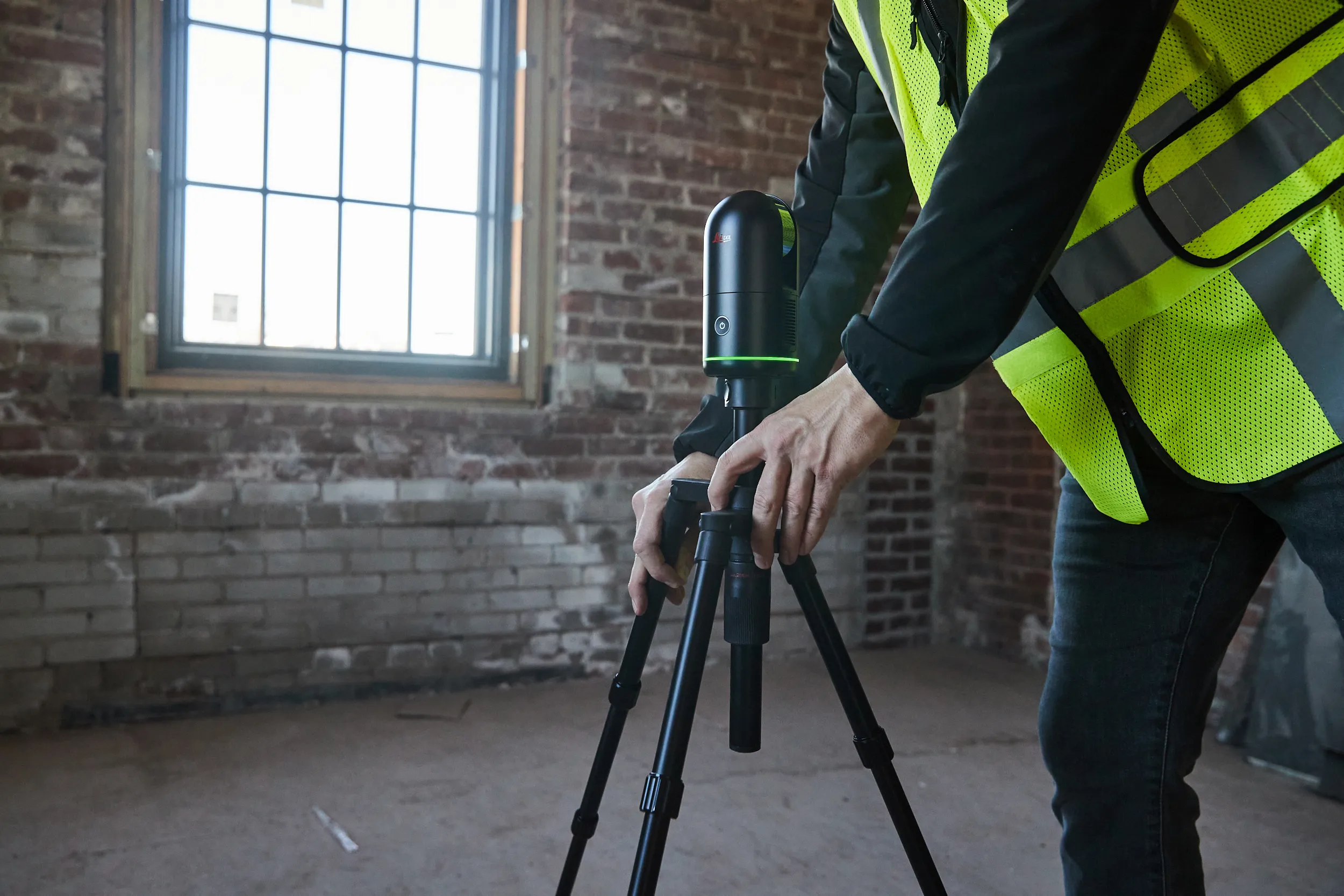
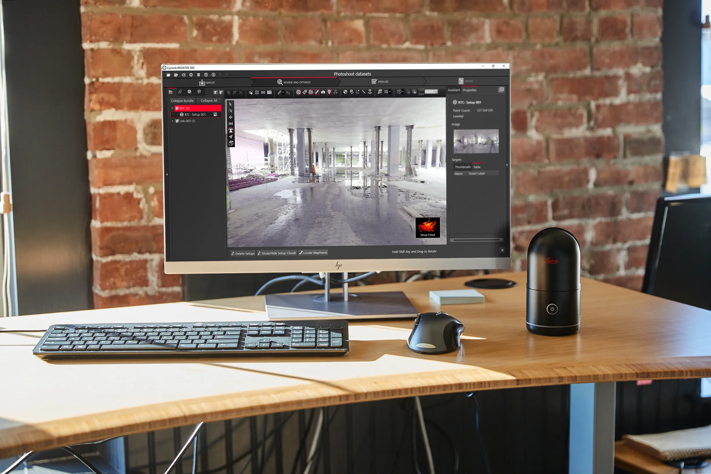
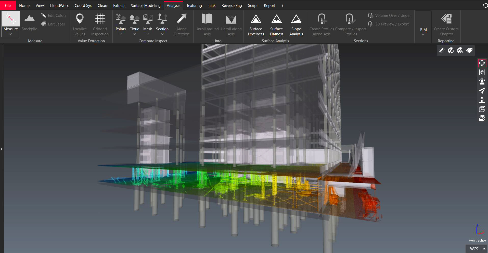
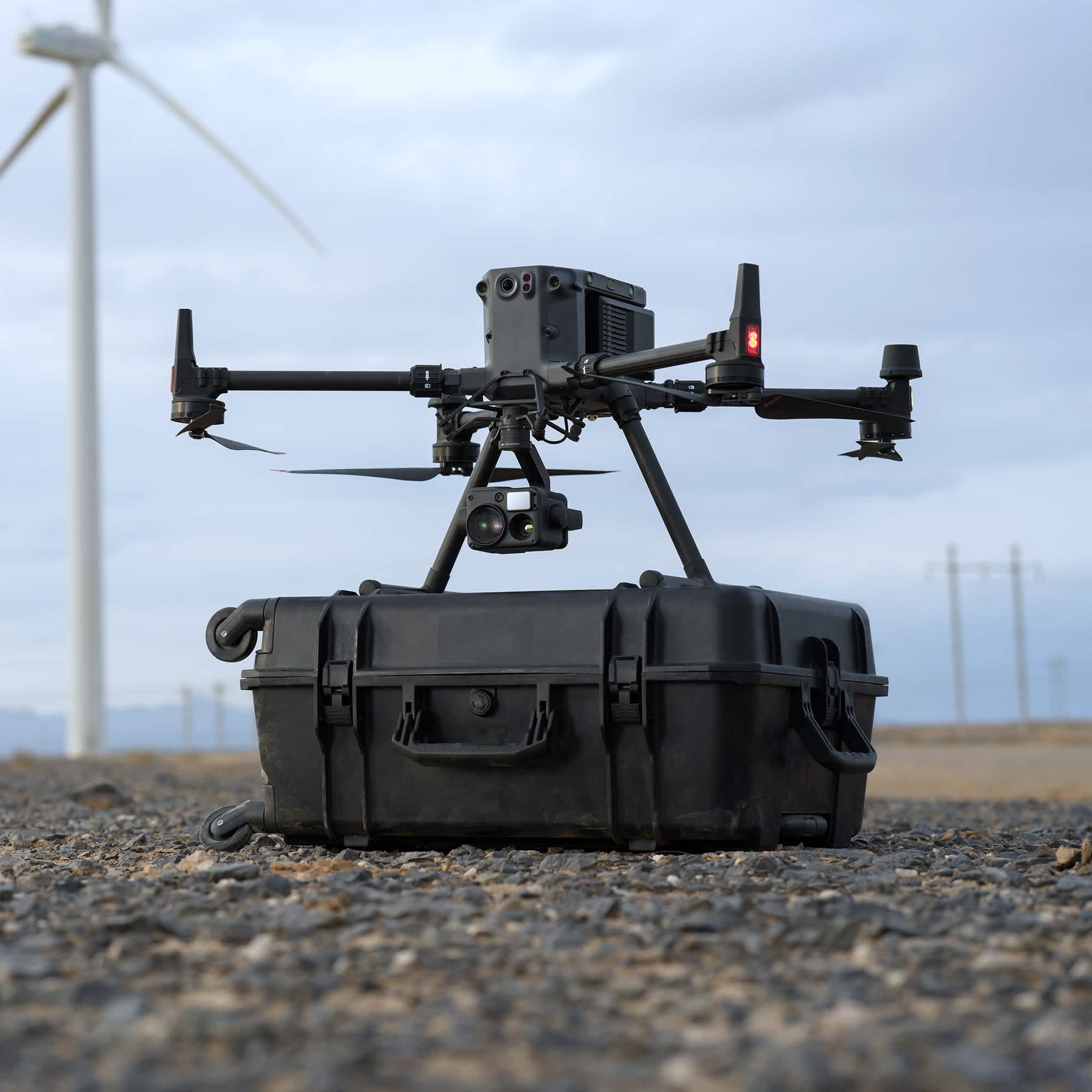
We utilize state-of-the-art laser scanners to capture precise, high-density point cloud data of any environment, from complex industrial plants to detailed architectural facades.
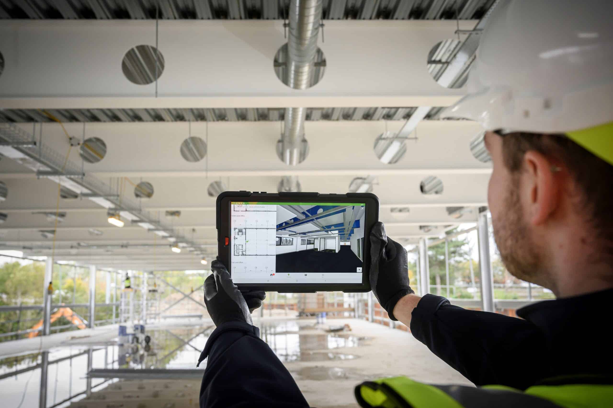
Our team transforms point cloud data into intelligent, data-rich Building Information Models (BIM) that can be accessed on-site, providing a digital twin for design, construction, and facility management.
Create digital twins, web viewers, and integrated spatial data systems that make your data accessible and useful.
Our Packages
Our packages are designed to meet the demands of modern professionals. From quick as-built surveys to fully integrated BIM models and digital twins, Pointcast delivers data you can build on.
Starting at R8,500
- On-site 3D Laser Scanning
- Point Cloud Registration
- 2D Floor Plans (CAD)
- 2D Elevations (CAD)
- Basic sections in DWG and PDF
Starting at R18,000
- Everything in Scan to Plan
- LOD 200-300 BIM Model
- Structural & MEP Elements
- CAD outputs: floorplans, elevations, and sections
- Geometry optimized for design & documentation
Starting at R30,000
- Everything in Scan to BIM
- Dimensional Deviation Reports
- Visual overlays and annotated reports
- Multi-phase scanning
- Comparison with Design Model
- Ongoing Model Updates & Support
Our Solutions
From initial surveys to final verification, we offer a complete suite of digital reality capture services tailored to your project's lifecycle.
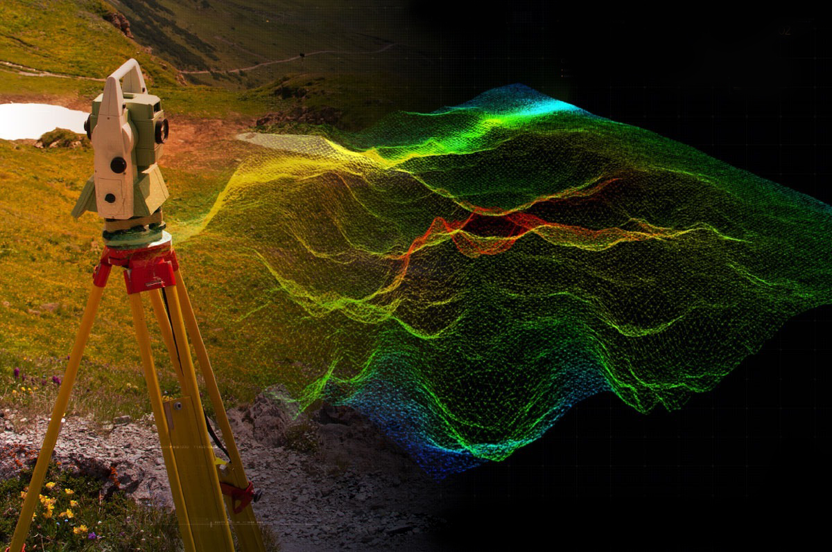
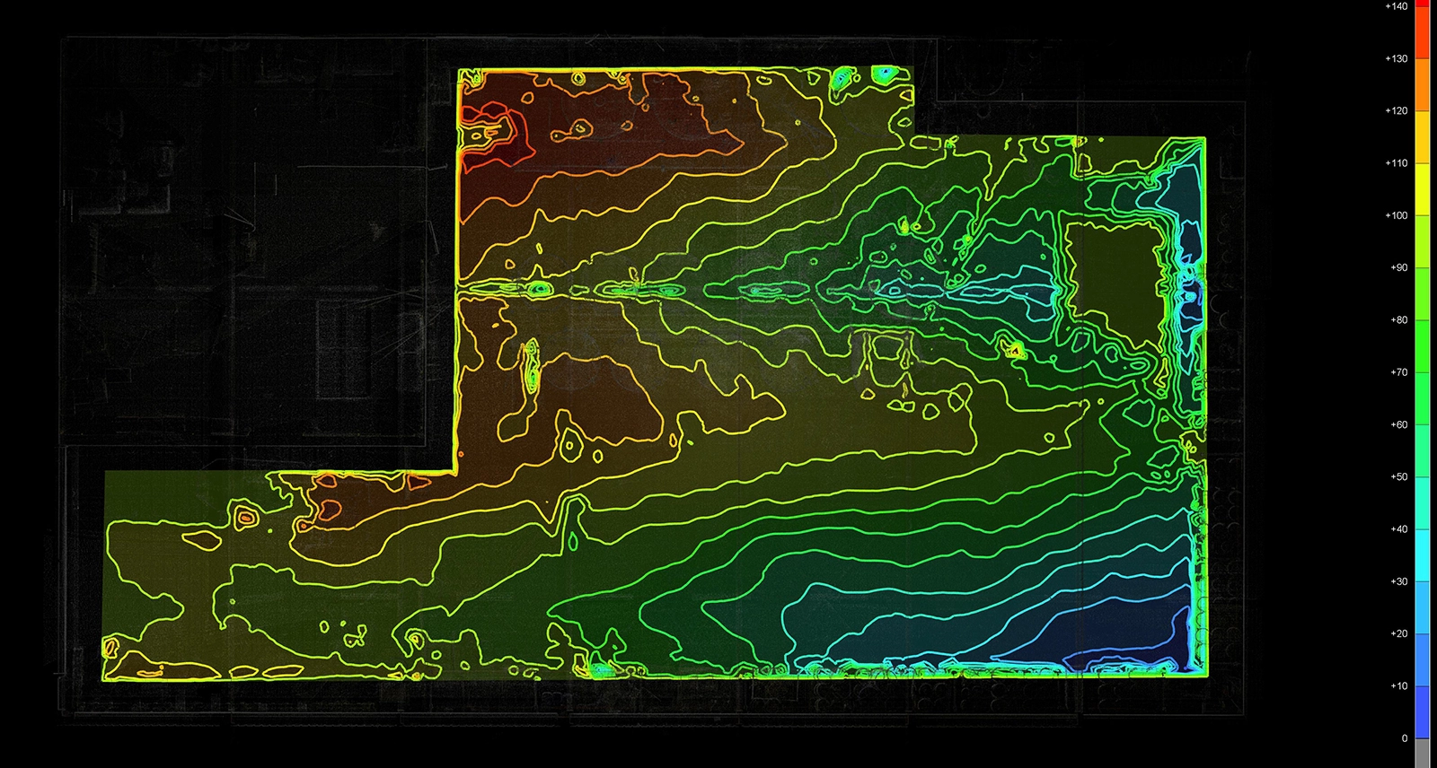
Delivering precise topographical data that maps all natural and man-made features, providing a critical foundation for project planning and design.
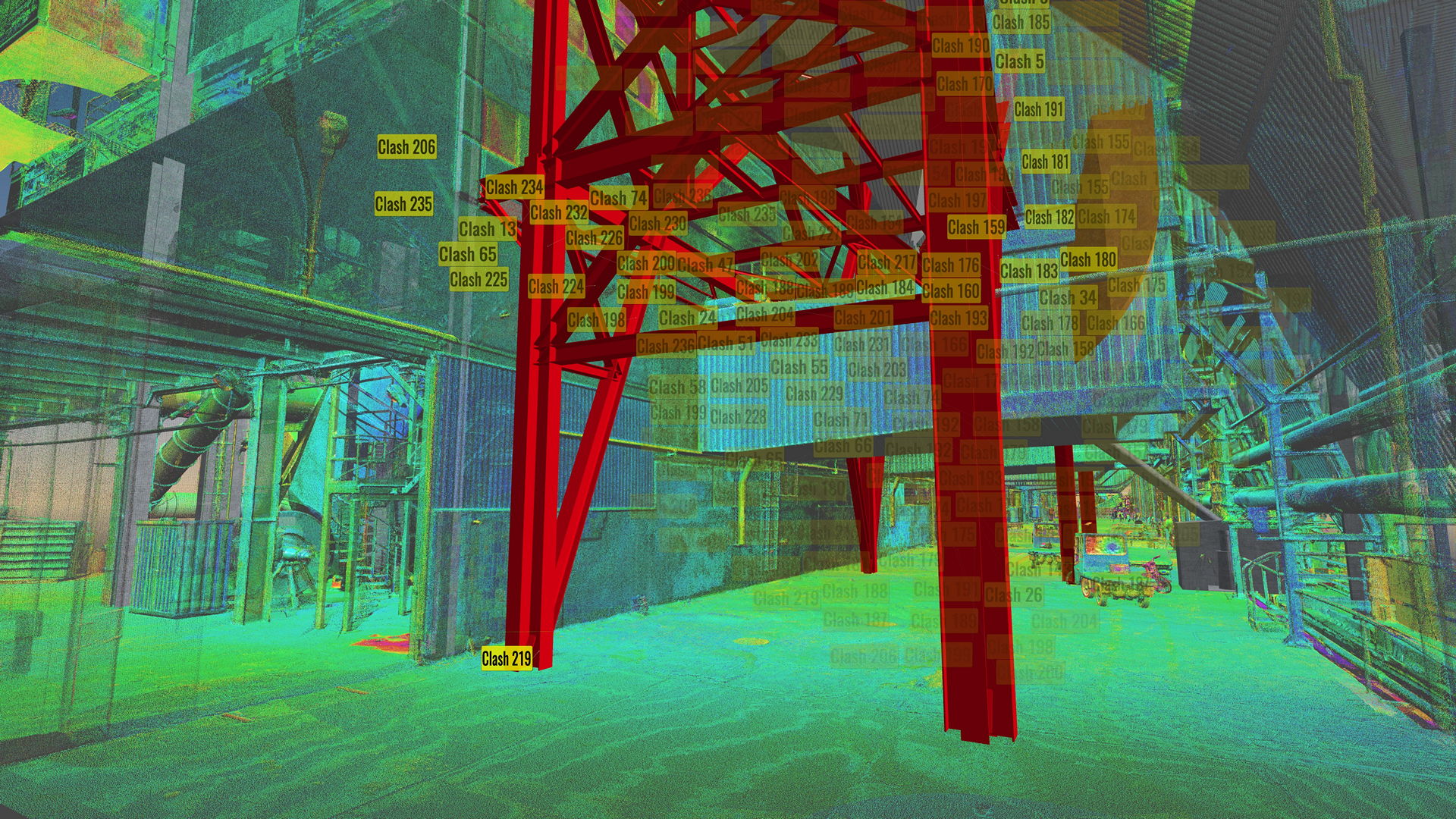
Identify, assess, and resolve conflicts between multidisciplinary models before construction begins, saving time and preventing costly rework.
Leverage precise laser scanning to capture detailed spatial information, enabling efficient area assessment and optimized layout planning.
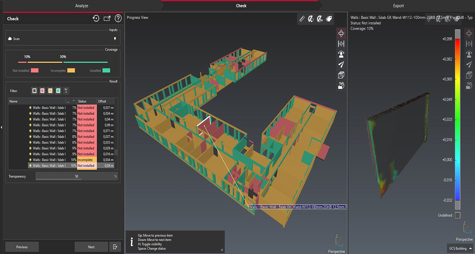
Ensure construction aligns perfectly with design intent by comparing as-built scan data against your design models at critical project stages.
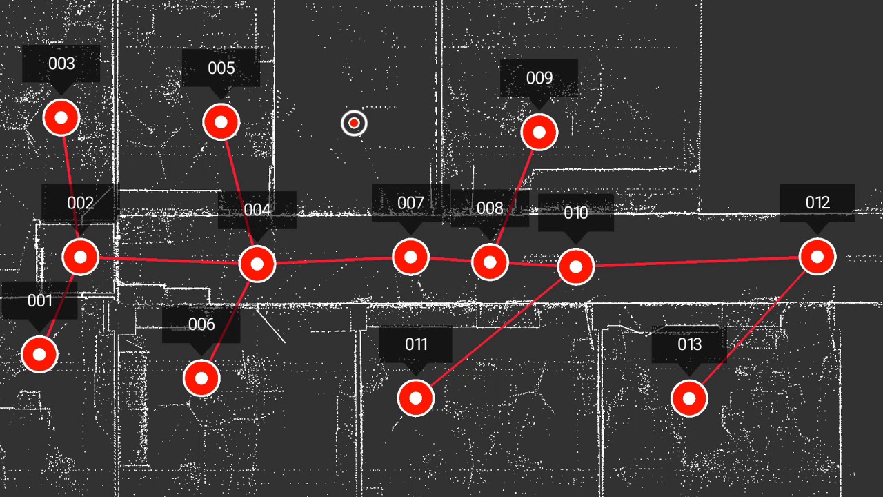
Receive a clean, fully-registered point cloud, ready for your team to process and integrate directly into your existing design workflow.
Capture the exact state of your asset post-construction with detailed 2D plans and 3D models, tailored to your required level of detail.
Our Project Showcase
Explore a selection of our successful projects across various industries.

.webp)
.webp)
Industries We Serve
Our expertise in digital reality capture benefits a wide range of sectors.
Providing architects with precise as-built data to inform design decisions and streamline renovations.
Enhancing project management with construction verification, progress monitoring, and quality control.
Creating accurate floor plans and virtual tours for property marketing and space management.
Modeling complex facilities for maintenance, retrofitting, and operational planning.
Digitally preserving historical sites and artifacts for conservation and academic study.
Supporting the planning and management of large-scale civil projects like roads, bridges, and utilities.
Trusted by Industry Leaders
We partner with innovative companies across a diverse range of sectors to bring their visions to life.


Frequently Asked Questions
Find answers to common questions about our services and process.